 AuScope GeoNetwork
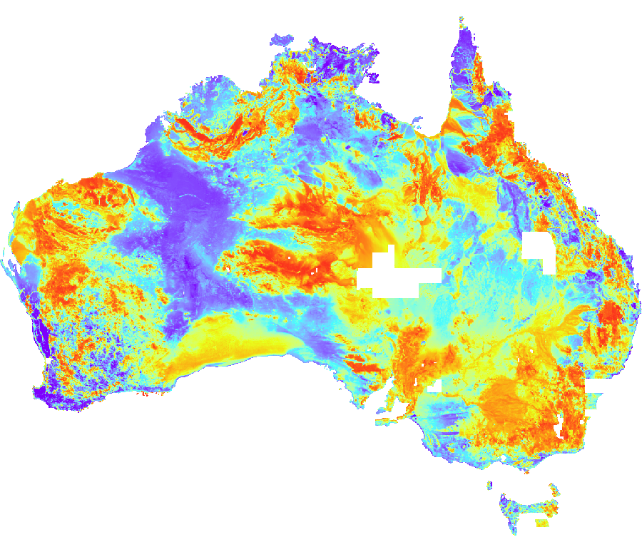
Unfiltered Potassium Element Concentrations Grid of Australia 2019
The unfiltered potassium grid is a derivative of the 2019 radiometric grid of Australia. The radiometric, or gamma-ray spectrometric method, measures the natural variations in the gamma-rays detected near the Earth's surface as the result of the natural radioactive decay of potassium (K), uranium (U) and thorium (Th). The data are collected on airborne geophysical surveys conducted by Commonwealth, State and Northern Territory Governments and the private sector. The 2019 unfiltered potassium grid has a cell size of about 100 m (0.001 degrees) and shows potassium element concentrations of the Australia region. Potassium is the seventh most abundant element in the Earth's crust. The potassium concentration grid can be used to locate minerals and compounds containing potassium.
Simple
- Status
- Point of contact
-
Role Organisation Electronic mail address Point of contact Geoscience Australia
- Spatial representation type
- Topic category
-
- Geoscientific information
Extent
Extent
))
- Maintenance and update frequency
- As needed
- Theme
-
-
Airborne Digital Data
-
Potassium
-
Australia
-
National Geophysical Compilation
-
Radiometrics
-
Geophysics
-
Grid
-
Earth Sciences
-
NCI
-
- Place
-
-
World
-
- Australian and New Zealand Standard Research Classification (ANZSRC): Fields of Research
-
-
Earth Sciences
-
Resource constraints
- Use limitation
- Access constraints
- Licence Unrestricted
- Use constraints
- Licence Unrestricted
- Language
- English
- Character encoding
- UTF8
- OnLine resource
-
geophys:radmap_v4_2019_unfiltered_pctk
Unfiltered Potassium Element Concentrations Grid of Australia 2019
- Hierarchy level
- Dataset
- Reference system identifier
- EPSG:4283
- Reference system identifier
- CRS:84
Metadata
- Metadata identifier
- urn:uuid/d25028d92d92787c6e0c680de70adaacf3ed01f9
- Language
- English
- Character encoding
- anyValidURI
- Contact
-
Role Organisation Electronic mail address Point of contact Geoscience Australia
Point of contact
Type of resource
- Resource type
- Dataset
- Metadata linkage
-
https://portal.auscope.org.au/geonetwork/srv/api/records/d25028d92d92787c6e0c680de70adaacf3ed01f9
- Date info (Revision)
- 2026-10-20T02:41:15.81061Z
- Date info (Creation)
- 2026-10-28T00:03:04
Metadata standard
- Title
-
ISO 19115-3
)))
