 AuScope GeoNetwork
National Gravity Compilation 2019 includes airborne DGIR 1VD grid
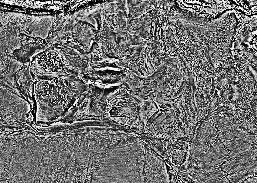
Gravity data measure small changes in gravity due to changes in the density of rocks beneath the Earth's surface. The data collected are processed via standard methods to ensure the response recorded is that due only to the rocks in the ground. The results produce datasets that can be interpreted to reveal the geological structure of the sub-surface. The processed data is checked for quality by GA geophysicists to ensure that the final data released by GA are fit-for-purpose. This National Gravity Compilation 2019 includes airborne DGIR 1VD grid is produced from the 2019 Australian National Gravity Grids B series. These gravity data were acquired under the project No. 202008. The grid has a cell size of 0.00417 degrees (approximately 435m). The data are derived from ground observations stored in the Australian National Gravity Database (ANGD) as at September 2019, supplemented by offshore data sourced from v28.1 of the Global Gravity grid developed using data from the Scripps Institution of Oceanography, the National Oceanic and Atmospheric Administration (NOAA), and National Geospatial-Intelligence Agency (NGA) at Scripps Institution of Oceanography, University of California San Diego. Airborne gravity and gravity gradiometry data were also included to provide better resolution to areas where ground gravity data was not of a suitable quality. Out of the approximately 1.8 million gravity observations, nearly 1.4 million gravity stations in the ANGD together with Airborne Gravity surveys totaling 345,000 line km and 106,000 line km of Airborne Gravity Gradiometry were used to generate this grid. The ground and airborne gravity data used in this grid has been acquired by the Commonwealth, State and Territory Governments, the mining and exploration industry, universities and research organisations from the 1940's to the present day. Station spacing for ground observations varies from approximately 11 km down to less than 1 km, with major parts of the continent having station spacing between 2.5 and 7 km. Airborne surveys have a line spacing ranging from 0.5 km to 2.5 km. The grid shows the first vertical derivative of the de-trended global isostatic residual (DGIR) anomalies over Australia and its continental margins. The DGIR grid was obtained by subtracting 3 quantities (i.e., the near-field isostatic correction, the far-field isostatic correction, and a first order trend correction) from Complete Bouguer Anomaly data (CBA) of the 2019 Australian National Gravity Grids B series. A first vertical derivative was calculated by applying a fast Fourier transform (FFT) process to the DGIR grid of the 2019 Australian National Gravity Grids to produce this grid.
Simple
- Status
- Point of contact
-
Role Organisation Electronic mail address Point of contact Geoscience Australia
- Spatial representation type
- Topic category
-
- Geoscientific information
Extent
Extent
))
- Maintenance and update frequency
- As needed
- Theme
-
-
Australia
-
gravity
-
grid
-
- Place
-
-
World
-
- Australian and New Zealand Standard Research Classification (ANZSRC): Fields of Research
-
-
Earth Sciences
-
Resource constraints
- Use limitation
- Access constraints
- Licence Unrestricted
- Use constraints
- Licence Unrestricted
- Language
- English
- Character encoding
- UTF8
- OnLine resource
-
geophys:Gravmap2019-grid-grv_dtgir_1vd-IncludesAirborne
National Gravity Compilation 2019 includes airborne DGIR 1VD grid
- Hierarchy level
- Dataset
- Reference system identifier
- EPSG:4283
- Reference system identifier
- CRS:84
Metadata
- Metadata identifier
- urn:uuid/cf7876f6009966267150e1f34b5d7aae1a137d48
- Language
- English
- Character encoding
- anyValidURI
- Contact
-
Role Organisation Electronic mail address Point of contact Geoscience Australia
Point of contact
Type of resource
- Resource type
- Dataset
- Metadata linkage
-
https://portal.auscope.org.au/geonetwork/srv/api/records/cf7876f6009966267150e1f34b5d7aae1a137d48
- Date info (Revision)
- 2026-10-20T02:41:38.31723Z
- Date info (Creation)
- 2026-10-25T00:00:49
Metadata standard
- Title
-
ISO 19115-3
)))
