 AuScope GeoNetwork
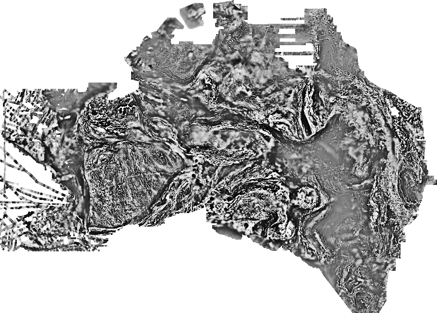
Magnetic Anomaly Map of Australia, Seventh Edition, 2020 - Enhanced Products Package - TMI RTP 0.5VD grid
This layer is a half vertical derivative of the Total Magnetic Intensity grid for the Magnetic Anomaly Map of Australia, Seventh Edition, 2019. The 2019 Total magnetic Intensity (TMI) grid of Australia has a grid cell size of ~3 seconds of arc (approximately 80 m). This grid only includes airborne-derived TMI data for onshore and near-offshore continental areas.
Since the sixth edition was released in 2015, data from 234 new surveys have been added to the database, acquired mainly by the State and Territory Geological Surveys. The new grid was derived from a re-levelling of the national magnetic grid database. The survey grids were levelled to each other, and to the Australia Wide Airborne Geophysical Survey (AWAGS), which serves as a baseline to constrain long wavelengths in the final grid. It is estimated that 33 500 000 line-kilometres of survey data were acquired to produce the 2019 grid data, about 2 000 000 line-kilometres more than for the previous edition. The grid has units of nanoTesla per km (or nT/km). The RTP processing followed a differential reduction to pole calculation up to 5th order polynomial. Magnetic inclination and declination were derived from the IGRF-15 geomagnetic reference model using a data representative date and elevation representative of the survey. A Fast Fourier Transform (FFT) process was applied to the original grid to calculate the half vertical derivative grid.
Simple
- Status
- Point of contact
-
Role Organisation Electronic mail address Point of contact Geoscience Australia
- Spatial representation type
- Topic category
-
- Geoscientific information
Extent
Extent
))
- Maintenance and update frequency
- As needed
- Theme
-
-
magnetics
-
grid
-
geophysics
-
Australia
-
- Place
-
-
World
-
- Australian and New Zealand Standard Research Classification (ANZSRC): Fields of Research
-
-
Earth Sciences
-
Resource constraints
- Use limitation
- Access constraints
- Licence Unrestricted
- Use constraints
- Licence Unrestricted
- Language
- English
- Character encoding
- UTF8
- OnLine resource
-
geophys:magmap_v7_2019_VRTP_05VD
Magnetic Anomaly Map of Australia, Seventh Edition, 2020 - Enhanced Products Package - TMI RTP 0.5VD grid
- Hierarchy level
- Dataset
- Reference system identifier
- EPSG:4283
- Reference system identifier
- CRS:84
Metadata
- Metadata identifier
- urn:uuid/28f9b394f90442ebd10f5a0260290faef6085803
- Language
- English
- Character encoding
- anyValidURI
- Contact
-
Role Organisation Electronic mail address Point of contact Geoscience Australia
Point of contact
Type of resource
- Resource type
- Dataset
- Metadata linkage
-
https://portal.auscope.org.au/geonetwork/srv/api/records/28f9b394f90442ebd10f5a0260290faef6085803
- Date info (Revision)
- 2026-10-20T02:41:31.457965Z
- Date info (Creation)
- 2026-10-24T00:01:41
Metadata standard
- Title
-
ISO 19115-3
)))
