 AuScope GeoNetwork
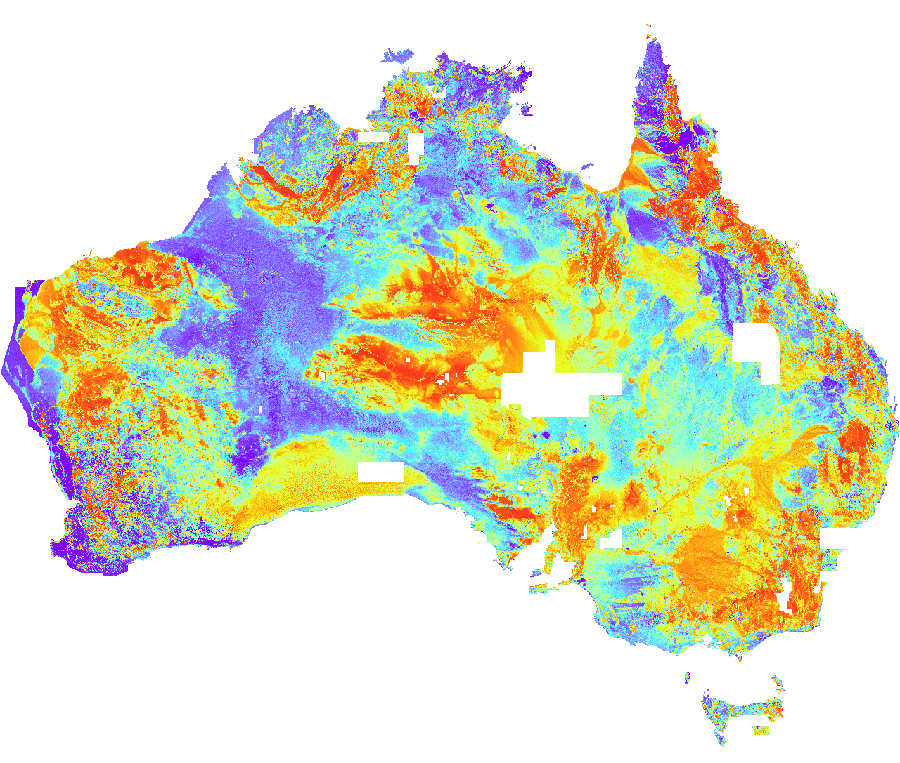
Radiometrics Filtered K percent Image - 2015
Low-pass filtered K element concentration (percent K). The Radiometric Map of Australia dataset comprises gridsof potassium (K), uranium (U) and thorium (Th) element concentrations, and derivatives of these grids. This third edition was derived by seamlessly merging 45 new survey grids with the Second Edition Radiometric Map of Australia (Minty et al., 2010). Details of the specifications of individual airborne surveys can be found in the 2014 Edition of the Index of Airborne Geophysical Surveys (Percival, 2014). Matching of the grids in the database was achieved using a program called Gridmerge, originally developed within Geoscience Australia and has now been commercialised. This program was used to merge 45 new surveys to the Second Edition Radiometric Map of Australia. The second edition merged over 550 individual grids to create the compilation (Minty et al., 2009), and the Australia-wide Airborne Geophysical Survey (AWAGS) airborne radiometric data was used to control the base levels of those survey grids which overlapped the AWAGS data (Milligan et al., 2009). As the second edition was used as a base grid for the Gridmerge operation the new Third Edition is essentially levelled to AWAGS. Filtering: Potassium, uranium, thorium and dose rate grids are available in both filtered and unfiltered versions. The low-pass filtering was achieved by applying a 7-point, degree-3 Savitzky-Golay filter (Savitzky and Golay, 1964) to each of the original survey grids prior to grid merging.
Simple
- Status
- Point of contact
-
Role Organisation Electronic mail address Point of contact Geoscience Australia
- Spatial representation type
- Topic category
-
- Geoscientific information
Extent
Extent
))
- Maintenance and update frequency
- As needed
- Theme
-
-
radiometrics
-
geophysics
-
geophysical survey
-
airborne digital data
-
grid
-
Australia
-
- Place
-
-
World
-
- Australian and New Zealand Standard Research Classification (ANZSRC): Fields of Research
-
-
Earth Sciences
-
Resource constraints
- Use limitation
- Access constraints
- Licence Unrestricted
- Use constraints
- Licence Unrestricted
- Language
- English
- Character encoding
- UTF8
- OnLine resource
-
geophys:radmap_v3_2015_filtered_pctk_x
Radiometrics Filtered K percent Image - 2015
- Hierarchy level
- Dataset
- Reference system identifier
- EPSG:4283
- Reference system identifier
- CRS:84
Metadata
- Metadata identifier
- urn:uuid/147cfa87844daa1d994f5e48023d148072c5efab
- Language
- English
- Character encoding
- anyValidURI
- Contact
-
Role Organisation Electronic mail address Point of contact Geoscience Australia
Point of contact
Type of resource
- Resource type
- Dataset
- Metadata linkage
-
https://portal.auscope.org.au/geonetwork/srv/api/records/147cfa87844daa1d994f5e48023d148072c5efab
- Date info (Revision)
- 2026-10-20T02:44:30.393921Z
- Date info (Creation)
- 2026-10-23T00:02:38
Metadata standard
- Title
-
ISO 19115-3
)))
